(1) Kings Arms, Kirkby Stephen
(2) River Eden from Franks Bridge
(3) Hartley
Other Links >>> |
|
COAST TO COAST PATH - Day 8
Kirkby Stephen to Keld
|
|
|
|
(1) Kings Arms, Kirkby Stephen |
(2) River Eden from Franks Bridge |
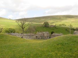
(3) Hartley |
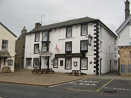
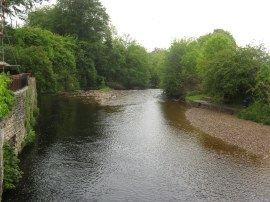
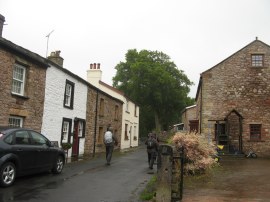
So the final days walk had arrived. This was another fairly short stretch of walking but considerably more demanding than the previous days as we headed up out of Kirkby Stephen over the Pennines to Keld. The weather once again started very poor, very strong winds, low clouds with drizzle turning to rain as we headed up into the hills. From our accommodation at the Kings Arms, photo 1, we headed down to cross over the River Eden at Franks Bridge, photo 2, before heading uphill along a path that leads to the hamlet of Hartley, photo 3.
 |
 |
 |
(4) Hartley Quarry |
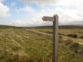
(5) Another of the attractive waymark posts |
(6) Path on Hartley Fell |
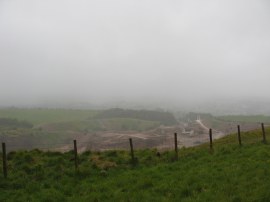
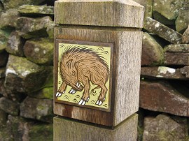
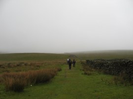
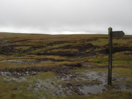
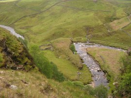
Here we joined a minor road, Birkett Lane, that headily steadily uphill round Hartley Quarry, photo 4, gradually leaving the fields behind. Reaching the end of the road we continued ahead along a bridleway that headed onto the open moors. Once again we passed another of the attractive waymark posts that I had first notices back near Shap Abbey, photo 5. Due to the low cloud visibility was very restricted and there were no views to be had, either back down to Kirkby Stephen and the Eden Valley or ahead to our next destination, the Nine Standards, high on top of the Pennines. Due to the amount of erosion in this area the Coast to Coast Path takes three different routes across this stretch of the Pennines, each route followed at different times of the year. We were following the red route which is the one used between May and July. After following a wall over Hartley Fell, photo 6, the red route heads off to the left along a path that heads uphill towards the Nine Standards alongside Faraday Gill.
 |
 |
 |
(7) Path on Hartley Fell |
(8) The Nine Standards |
(9) Trig Point, Nine Standards Rigg |
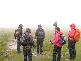
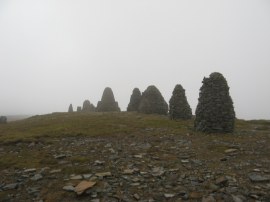
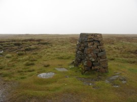
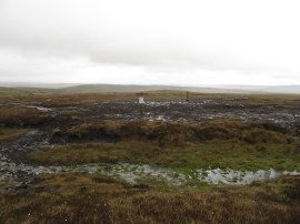
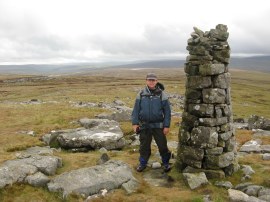
At this junction of paths, photo 7, we caught up with the two ladies, who we had seen a few times while out walking and had been staying at the White Lion Hotel in Patterdale. Earlier on the days walk we had found a bag of sweets on the ground which we had correctly guessed belonged to them and were now able to hand back. There was almost no visibility as we made our way over Hartley Fell in driving rain up towards the Nine Standards which only became visible when we reached them. The Nine Standards, photo 8, are a line of nine cairns, some of which were originally more than four meters high, and are just to the north of the fell's summit. Situated at a height of 650 m, their original purpose is uncertain but one possibility is that they marked the boundary between Westmorland and Swaledale. It was bitterly cold in the rain and almost gale force wind and we did not linger too long at the cairns before setting off over the moors, although there were a few brief gaps in the cloud which opened up the views for a few seconds at a time and appeared to indicate that better weather was on the way. From the Nine Standards the route heads past a trig point, photo 9, the first that I had spotted so far on this walk, which at 662 mtrs also makes this the highest point of the rest of the Coast to Coast walk to Robin Hoods Bay.
 |
 |
 |
(10) Path over the Pennines |
(11) White Mossy Hill |
(12) Slender stone cairn |
The path follows a generally southerly course for the next couple of miles along the top of the Pennines, only gently heading downhill. This area marks the watershed between west and east and also by White Mossy Hill we crossed from Cumbria into Yorkshire. Fortunately by this stage the rain had stopped and we were finally able to see some views as well as helping us with the navigation; although at all times it was possible to make out the well trampled route of the path, photo 10. It was slow going along this part of the route as the very strong wind was blowing at right angles to us and there were numerous areas of peat bogs that needed to be navigated around to try and find the best route across. Photo 11 was taken at the point where the Red and Blue routes split up on White Mossy Hill. Generally though this section was not as difficult or wet as I had been expecting. We stopped for a short break by a small stone pillar, photo 12, where there were also some rocks to provide shelter, before heading down a little more steeply to join a track that heads due east alongside Ney Gill.
 |
 |
 |
(13) Path by Ney Gill |
(14) Wooden Hut |
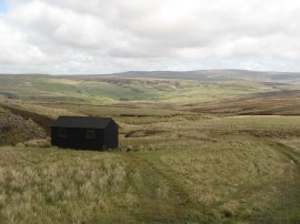
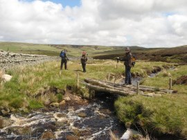
(15) Crossing Ney Gill |
As soon as we reached this track, photo 13, the walk became much easier as the path improved and we now had the winds behind our backs and the sunshine and lower altitude made it feel much warmer. We stopped for another short break at a wooden shooting hut, photo 14, before continuing on along the path which is followed down to Whitsun Dale. There were a couple of crossings of Ney Gill to undertake, not all of which had a bridge as in photo 15, and one of these was a little tricky to cross due to the depth of the water which I managed to briefly get over the top of one of my boots; before we joined a farm track which led round to Ravenseat Farm.
 |
 |
 |
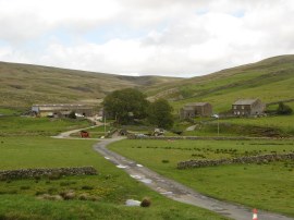
(16) Ravenseat Farm |
(17) Whitsundale Beck |
(18) Bridge over the River Swale |
There is a cafe attached to the farm, photo 16, however much to the disappointment of the others who were looking forward to a cup of tea, it was closed when we went by. The route crosses a stone bridge over Whitsundale Beck and joins a footpath which climbs up to run above the beck which flows through the bottom of a deep valley, photo 17. This path then heads downhill, past a number of abandoned farms and barns, down to a bridge over the River Swale, photo 18. On the way we stopped besides one of these barns for a quick lunch stop although it was not possible to get out of the wind and I soon began feeling a little chilly again despite wearing two T shirts, my thick fleece and waterproof jacket.
 |
 |
 |
(19) River Swale |
(20) Wain Wath Force |
(21) Approaching Keld |
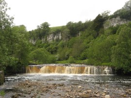
Crossing the river, photo 19, we joined a road which we then followed down to the village of Keld. There is a footpath alternative to Keld but the road route was recommended as it passed by Wain Wath Force, photo 20, although the view of some of the falls were obscured by trees. The road was quite quiet and it wasn't long before we were approaching the village, photo 21, and the end of this leg of the walk.
 |
 |
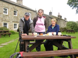
(22) Tea and cake in Keld |
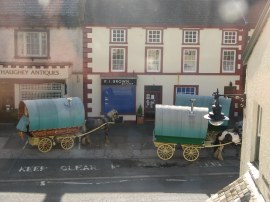
(23) Caravans in Kirkby Stephen |
Reaching Keld we headed down to the campsite where we had a very reasonably priced cup of tea and slice of cake, photo 22, while we waited in the now bright weather for our taxi back to Kirkby Stephen having walked another 12.1 miles along the route. It was amazing how the weather had brightened up during the day; if only we had had a few longer spells of sunny weather during the week. Also having a drink outside the little cafe at the campsite was a former work colleague who had recently retired; the second time I have met someone from work while out walking in the middle of nowhere. We had an easy transfer back to Kirkby Stephen and later on headed out to enjoy a nice curry to round off the week. The Appleby Horse Fair was being held the following week and there were already a large number of people in town on their way there. Some driving great big 4x4's, others using more traditional means of transport, photo 23.
Hopefully when we walk the second half of the Coast to Coast path next year which we are again doing in May, the weather will be a little drier and less windy. However despite the weather this had been a very enjoyable weeks walking and I am definitely looking forward to the second part of the walk. This was the first time I had walked for 8 consecutive days and I was pleased how my fitness held up, in fact it improved as we went on. It took a day of two to get used the routine, and to realise a giant breakfast was not the best way to start the day when there is a steep hill outside the back door, but all in all it was a very positive experience. With the kids getting older hopefully this will be the first of many longer trips away.
As usual I have uploaded the route of the walk which can be accessed here: Coast to Coast Path Day 8.
If you would like to comment on this walk you can do so here:
![]() Back to:Walk index page
Back to:Walk index page
| ©2012 Bertuchi.co.uk. Please contact me using the email button on the right if you have any questions or comments regarding the site. Any feedback and additional information about places of interest on the walks is always welcomed. All rights reserved. Please contact me if you want to use any of the images or information from the site. ENJOY YOUR WALKING |
|