Chiltern Way
Other Links >>> |
|
CHILTERN WAY - Part 10
Whipsnade to Chalton
|
|
Chiltern Way |
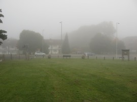
I did this walk on Sunday 7th October 2012. I had left home in bright sunshine but arriving at my parking spot by the Whipsnade Tree Cathedral the weather was grey and gloomy with a thick mist that was to linger for most of the day. It was also a very chilly morning, the car thermometer showing only 6c when I reached Whipsnade which was much cooler than recent. This weather was quite localised though and I received a couple of phone calls from people telling me what a lovely day it was to be out walking!
 |
 |
 |
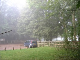
(1) Parked up by the Tree Cathedral |
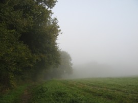
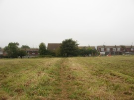
(2) Path besides Sallowsprings wood |
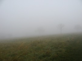
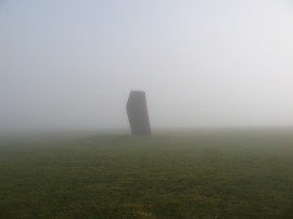
(3) Fog on the Dunstable Downs |
From the car park, photo 1, I headed up a footpath which runs alongside the Tree Cathedral which is followed up to a lane. Here the Chiltern Way heads to the left for a few yards before heading off to the right around the edge of the Sallowsprings Nature reserve before heading back round to rejoin the same lane. The path then continues up this lane, passing a number of houses, before joining an unsurfaced track running along the edge of Sallowsprings wood. The route then reaches an area of open ground besides the wood, photo 2, where the Chiltern Way heads to the left along a bridleway that runs along the top of the Dunstable Downs. Sadly though with the misty weather, photo 3, all the potential views were completely hidden and I could have been walking almost anywhere.
 |
 |
 |
(4) Dunstable Downs |
(5) Dew covered cobweb |
(6) Path across the Dunstable Downs |
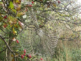
I then followed the path ahead across the top of the Downs joining a surfaced path close to the Dunstable Downs visitors centre although this remained shrouded in the mist, photo 4. The still misty weather had coated everything with droplets of water, highlighting the cobwebs on the greenery lining the path, photo 5. I followed this path, photo 6, up towards Knoll Hill where I detoured from the surfaced path, heading across the grass on the left to the top of the hill.
 |
 |
 |
(7) Knoll Hill |
(8) Approaching the B489 road |
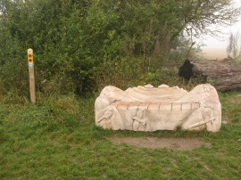
(9) Wooden Bench nr Dunstable |
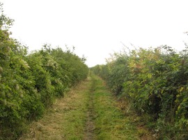
I then continued on past the knolls on Knoll Hill, photo 7 which are the remains of some Neolithic barrows. From here the path then starts descending quite steeply off the downs to the junction of the B489 and and B4541 roads on the outskirts of Dunstable, photo 8. I crossed over the road at the horse crossing to the left of the roundabout on the Tring Road before heading a short distance to the right where the Chiltern Way joins a green lane on the left which runs between houses. This lane gradually becomes more open as the houses are left behind to be replaced by fields on either side. The Chiltern Way follows this lane for about 0.4 of a mile before following a tarmac path round to the right by a carved wooden bench, photo 9.
 |
 |
 |
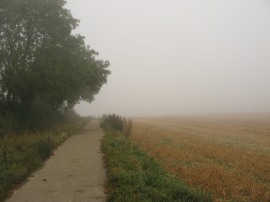
(10) Path nr Dunstable |
(11) Heading towards Blue Waters wood |
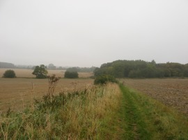
(12) Field nr Bidwell |
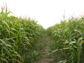
The path now runs along the edge of a large open field with a hedge to the left although I could still not actually see that much of the surrounding countryside, photo 10. The route continues along this path as it becomes a hedge lined lane which starts heading gently downhill. The Chiltern Way then follows the lane down the hill before bending round to the right to pass under some old railway lines where the route joins a surfaced track that curves round to the right, passing some attractive farm buildings and houses at Sewell. Reaching the entrance to Sewell Manor the route joins an enclosed footpath on the left; this leaves the road and heads down round the back of some gardens before crossing a stile into a field. A vague track led across to the far side of this field before heading to the left through a patch of scrubby ground with low trees. This leads down to a rather lopsided plank bridge over a drainage ditch where the Chiltern Way heads to the right running along the edge of a large field which was planted with maize when I went by. Reaching the end of this long field the route heads to the right along another field edge path which heads up towards Chalk Hill before heading to the left up a flight of 65 or so wooden steps which leads up to the A5 road. The route then heads to the right along the A5 until just before a bus stop on the other side of the road where the route heads down a shorter flight of steps to join a minor road. Here the Chiltern Way heads briefly to the left before joining a footpath on the right besides a house which soon leads out into a field. The footpath then continues on along the field edge, passing a rather smelly sewage works on the left as the route makes its way across the gently rolling countryside towards the Blue Waters wood, photo 11. This is built on the site of an old chalk pit and when the pit closed the site was used as tip before being capped with topsoil and the wood planted. The path follows a well surfaced path along the edge of the trees up to a concrete track where the Chiltern Way heads to the left along a footpath that runs across the corner of a large flat field. Reaching a hedge the path heads to the right along a rather indistinct short stretch of path which is followed up to the field boundary.This path was not that clearly signposted and anyone looking at the GPS trail will see I continued ahead acrosss to the far side of the main field before I realised I was off course. Back on track, a tight gate leads into a narrow band of trees before rejoining the concrete surfaced track running from the wood which is then followed off to the left down to the A5120 road. Here the Chiltern Way heads to the right, passing the Old Red Lion pub before crossing over the road and joining a footpath on the left. This bears soon back on itself to the left, rising up over a middle of a field which was also planted with maize, photo 12, and was almost like walking in a maize maze as the views were rather restricted.
 |
 |
 |
(13) Path nr Grove Farm |
(14) Heading down to cross the A4146 |
(15) Green Lane approaching Chalton |
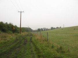
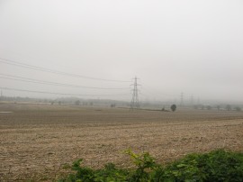
The path then runs along the edge of a very large open field which heads off up to the right of the path. The field edge path eventually passes some playing fields and reaching the far side of the field heads through a rather overgrown section of hedge and across a wooden footbridge over a small stream into a small paddock. Here the route heads to the right before crossing over another small footbridge that leads through a small area of trees and out into a field which was being grazed by sheep. It was now approaching midday and the mist had lifted considerably from ground level although it was still a very grey and gloomy day. Reaching the end of this field the path headed along a rather overgrown stretch of path through a band of scrubby trees before joining a broader path which continued ahead alongside a number of fields with a hedge on the right. This is followed up to a bridleway where the Chiltern Way heads to the left, now running along the bottom edge of a field and paddocks with a hedge now on the left hand side of the path, photo 13. This path heads past some stables at Grove Farm and joins another footpath on the right that heads up along the side of the last paddock. Reaching the end of this stretch of path the Chiltern Way heads to the right along a hedge lined track that runs along the top of a low ridge with fields sloping gently down on either side, photo 14. Away to the left there was a large Sundon electricity sub station visible through the mist with lines of electricity pylons heading off in all directions. This pleasant lane, photo 15, gradually becomes broader and is followed down until the route passes under a line of electricity pylons.
 |
 |
 |
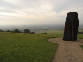
(16) Chalton |
(17) The end point of this stage |
(18) View over Dunstable |
Shortly after these pylond the Chiltern Way joins a footpath on the left that heads down across a field and into the village of Chalton, photo 16. Reaching Chalton the route heads down between some houses and continues ahead along Chalton Heights for a short distance before joining a footpath on the left. This curves round the back of houses to cross a driveway and continues on along the edge of small childrens playground before joining a short stretch of path which leads down to the B579 Luton road, opposite the Star pub, photo 17, which is where I finished this stage of my walk having walked a further 9.4 miles along the path. This was 0.5 mile longer than the distance shown in the guidebook, something that happens quite often on my walks along the Chiltern Way.
 |
 |
(19) Kensworth Chalk Quarry |
(20) Back at the Dunstable Downs |
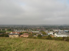
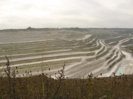
From Chalton I joined a footpath that headed back over the ridge and down across the Sundon Road to Chalton Cross Farm. Here I followed a path along the edge of a large open field which runs parallel to the M1 motorway. Eventualy this stretch of path led down to the houses of Houghton Regis and Dunstable. I then had a long, but perfectly pleasant, walk through the suburban housing estates down to the A 505 which I followed round to Blows Down. Here the path headed steeply uphill towards the top of the downs opening up good views over Dunstable and the area I had just been walking, photo 18. At the top of the hill I joined a path that headed to the right along the edge of hill, the path for a while running parallel with the route of the Luton Dunstable guided busway which is currently under construction. Path then follows the edge of the downs round to the left before I descended from the hilll and headed through a housing estate at Downside up to the A5 road. Here I headed briefly to the left before turning to the right up Beech Road. Where this road bends round to the left I continued ahead along a footpath across a field before heading through a patch of woodland on the left. This leads back to Beech Road where another short stretch of path led up to a footpath running around the edge of the giant Kensworth Chalk Quarry which suddenly, and completly unexpectedly, came into view. Seeing this, photo 19, was the highlight of the days walk and I was really pleased I had chosen this route for my trip back to the car. The path winds its way round the quarry for some distance before I joined a footapth that wound its way across fields to Kensworth. From their I headed over to Whipsnade Heath from where it was just a short walk further back to the car.
As usual I have uploaded the route of the walk which can be accessed here: Chiltern Way Stage 10 Route.
Reaching the car I had walked a total distance of 17.9 miles. The murky weather in the morning rather spoilt the walk along the Chiltern Way on what should have been a very scenic part of the path. It was good to be out and this was an area I had not really walked before and I enjoyed my return walk back to the car over Blows Down and past the quarry. Once back at the car I drove up to the Dunstable Downs visitor centre to look at the views I had missed, photo 20, although the light was still not that good for taking photos.
![]() Back to:Walk index page
Back to:Walk index page
| ©2012 Bertuchi.co.uk. Please contact me using the email button on the right if you have any questions or comments regarding the site. Any feedback and additional information about places of interest on the walks is always welcomed. All rights reserved. Please contact me if you want to use any of the images or information from the site. ENJOY YOUR WALKING |
|