(1) Bourne End Railway Bridge
(2) Path besides Cock Meadow
(3) Sail Boat nr Cookham
Other Links >>> |
|
THAMES PATH - Part 9
Bourne End to Datchet
We did this stage on Sunday 10th July 2011. After a pleasant nights stay in Marlow we drove over to Datchet before taking Sara's car back over to Bourne End to resume our walk along the path. Once again we parked in the car park by Bourne End station before taking the short stretch of footpath that heads alongside the railway lines back to the River Thames.
|
|
|
|
(1) Bourne End Railway Bridge |
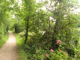
(2) Path besides Cock Meadow |
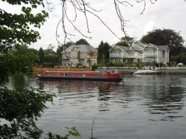
(3) Sail Boat nr Cookham |
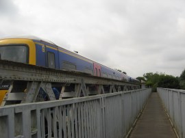
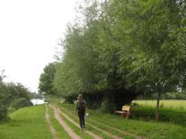
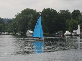
Here we crossed over the Thames along a footbridge, cantilevered out from the railway bridge, which was added in 1992 to take the Thames Path across the river, photo 1. The Thames Path then heads downstream towards Cookham alongside Cock Marsh, photo 2, which is an area of flat water meadows covering 46 acres and has been common land used for grazing since 1272. It was bought by local villagers and given to the National Trust in 1934. From there it was a only a short walk further along Cookham Reach to the town of Cookham. On the water were a number of sail boats from the Cookham Reach Sailing club making good use of the morning breeze, photo 3.
 |
 |
 |
(4) Holy Trinity Church, Cookham |
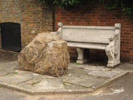
(5) Sarsen Stone, Cookham |
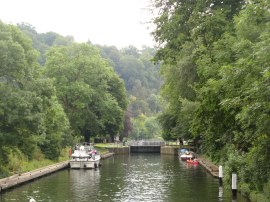
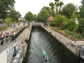
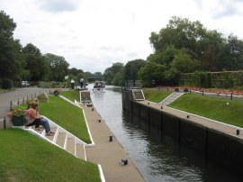
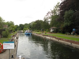
(6) Cookham Lock - 30 |
For me Cookham marked at important part of the path as it marked the point where I reached a section of the Thames Path I had already walked before, all be it for just a few yards when I was making my way over from Cookham station to the start of the Beeches Way. That day I walked over to West Drayton on the suburban edge London however due to the meandering route of the Thames it will be a couple of days walking until we reach a similar point.
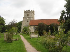
Just past the sailing club the Thames Path leaves the river and heads up through the churchyard of Holy Trinity Church, photo 4. After passing through Churchgate the route then heads to the right along the Sutton Road, where there is a Sarsen Stone, photo 5, in the pavement besides the path, before heading to the left down Mill Lane. However before heading down to Mill Lane we took a short diversion from the main route to go and photograph Cookham Lock. For a while at Cookham the Thames splits into four channels and on one of these is the lock which is not on the route of the Thames path. Having had a photograph of every lock so far was keen to see Cookham Lock as well. Thus we headed down Odney Lane and continued over a footbridge to Formosa Island, which is one of the largest on the non tidal Thames, before crossing over to Mill Island from where I was able to get my photograph, looking downstream from the bridge over the lock cut, photo 6.
 |
 |
 |
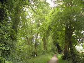
(7) Path heading towards Maidenhead |
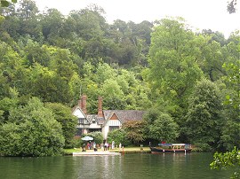
(8) River Thames nr Maidenhead |
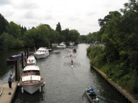
(9) Boulters Lock - 31 |
Back on route we headed down Mill Lane and, passing the last houses, joined a footpath which runs along the edge of some woodland back down to rejoin the riverbank. Here the Thames Path heads along a tree flanked track, photo 7, with fields to the right and the river on the left with steeply wooded hills rising up on the opposite bank although due to the riverside trees views across to them were somewhat restricted. There were the occassional gaps in the trees however and at one point we passed a nice house on the waterfront on the opposite bank, photo 8, in an idyllic Thames location. This stretch of path is followed down to Maidenhead and one the way we passed several volunteers who were cutting back the greenery lining the footpath, work that is always much appreciated. As the path approaches Maidenhead it runs alongside some gardens before joining the A4094 road close to Boulters Lock, photo 9, where we stopped for a short drinks break.
 |
 |
 |
(10) View below Boulters Lock |
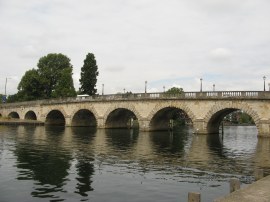
(11) Maidenhead Bridge |
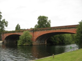
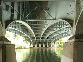
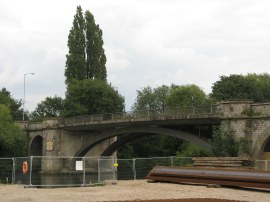
(12) Maidenhead Railway Bridge |
Downstream was a line of boats waiting to enter the lock, photo 10, as we headed alongside the road the half a mile towards Maidenhead Bridge, photo 11. Here the Thames path once again crosses over the river moving from Berkshire back to Buckinghamshire. Once over the bridge the route heads to the left through a small and run down boat yard before following the path under the river. It was then just a short walk along the waterfront until we reached the Maidenhead Railway Bridge, photo 12. The bridge was designed by Isambard Kingdom Brunel, and it was completed in 1838. The railway is carried across the river on two brick arches, which at the time of building were the widest and flattest in the world, a fact commemorated by a plaque on the side of the bridge.
 |
 |
 |
(13) Thames Path below Maidenhead |
(14) River Thames nr Maidenhead |
(15) Bray Lock - 32 |
Below the rail bridge the route runs alongside a road for a short distance, running past waterfront gardens before joining another tree lined section of path running alongside the river, photo 13, this time with fields away to our left. Once again there were the odd gaps in the vegatation giving views across the river to the grand houses lining the opposite bank, photo 14. Nearing Bray Lock, photo 15, the route runs alongside a more open area of fields before heading past the lock from where it is only a short walk further downstream to reach the M4 motorway.
 |
 |
 |
(16) Underneath the M4 road bridge |
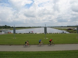
(17) Dorney Lake |
(18) Lunchtime |
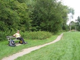
The route heads under the curving metal spans of the roadbridge, photo 16, although first we had a very short detour as we spotted a flight of steps heading up besides the bridge and were intrigued to see where these went as there was a motorway above. However it turned out that there was also a footpath running alongisde the motorway for a short distance too. Back on the river the path passes by the end of some long gardens, with Monkey Island in the middle of river, and reached a tall footbridge over the river, close to the entrance to Bray Marina. Just past this, on another section of hedge lined track, we once again made a little detour from the path. This time heading along a footpath on the left that headed up towards the far end of Dorney Lake. Dorney Lake is the Eton College rowing lake and is also being used as the venue for the 2012 Olympic rowing competition. While we were there a triathalon was taking place with the cyclists heading round and round the perimeter path. Once again returning back to the river we headed along another section of fairly enclosed path, running roughly parallel to the 2.2 km lake. At one point we passed a large building on the opposite bank where dragon boat racing was taking place and we had a brief stop to watch the start of one of the races which was being competed in by three boats. Reaching the end of the lake the path follows the river round to the left and we stopped on a bench close to a boat house for our lunch break, photo 18. The soles of my feet were once again feeling quite tired at this point and this was a very welcome rest.
 |
 |
 |
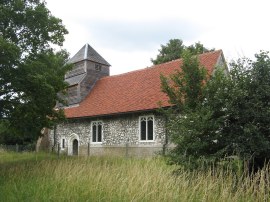
(19) St Mary Magdalene Church, Boveney |
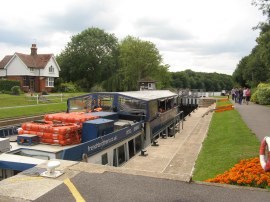
(20) Boveney Lock- 33 |
(21) Heading towards Windsor |
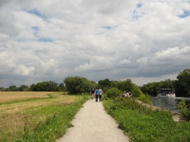
Back on the path again we soon passed by St Mary Magdalene Church, Boveney, photo 19 and reached Boveney Lock, photo 20, which was almost completely filled by a large pleasure boat passing through. The path now heads along a more open stretch of riverbank on a well surface stretch of path as the river starts making its way towards Windsor, photo 21.
 |
 |
 |
(22) View towards Windsor Castle |
(23) View across Windsor Bridge |
(24) Round Tower, Windsor Castle |
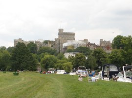
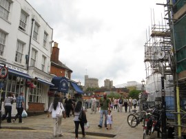
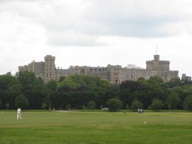
Away to the right on the opposite bank there were occasional views over to the Windsor Racecourse. This was a busy section of river with boats of all sizes heading up and down the water. The path follows the water edge round a little loop in the river before passing under the A332 road bridge and then another rail bridge to reach Brocas Meadow. Here the river was lined with boats and people having picnics with Windsor Castle dominating the skyline ahead, photo 22. Leaving the Brocas Meadows the path leaves the water edge and heads a few yards along Brocas Street to reach Eton High Street. Here the route heads to the left crossing Windsor Bridge, photo 23, over the river to Windsor to rejoin the towpath on the opposite bank. Here the path heads along the waterfront below the castle, photo 24, before continuing ahead along a fence lined footpath.
 |
 |
 |
(25) Romney Lock - 34 |
(26) Windsor Castle |
(27) Victoria Bridge, Windsor |
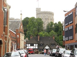
This leads on to a surfaced lane which is followed down past some red brick buildings towards a small boatyard where a short detour to the left took us to Romney Lock, photo 25. Continuing ahead, the route joins a tree lined path which heads under the Black Potts Railway Bridge and then alongside an area of playing fields from where there were good views back to Windsor Castle, photo 26. This section of path is followed down to the Victoria Bridge, photo 27, which the route crosses over to the opposite bank. Once over the river the Thames Path joins a footpath on the right that runs through a small wooded area up to the Windsor Road in Datchet.
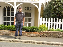 |
(28) Myself, Datchet High Street |
From here it was just a short walk along the road to the junction with the High Street, photo 28, where we finished this stage of the walk.
Back at the car we had walked 15.0 miles although with our detours only about 13.5 was along the Thames Path.
As usual I have uploaded the route of the walk which can be accessed here: Thames Path Stage 9 Route.
If you would like to comment on this walk you can do so here:
![]() Back to:Main index page
Back to:Main index page
| ©2012 Bertuchi.co.uk. Please contact me using the email button on the right if you have any questions or comments regarding the site. Any feedback and additional information about places of interest on the walks is always welcomed. All rights reserved. Please contact me if you want to use any of the images or information from the site. ENJOY YOUR WALKING |
|